Tokyo Metropolitan - Flood Control Integrated Information System (Bureau of Construction River Division) Provide

This website provides rainfall amount and river water level information observed in Tokyo, as well as the warnings, alarms and special alarms in real time.

What is the Flood Control Integrated Information System?

The Flood Control Integrated Information System aims to promptly and accurately provide information regarding flood control such as river water level and rainfall amount, in order to mitigate the damages caused by floods, high tides and sediment disasters.
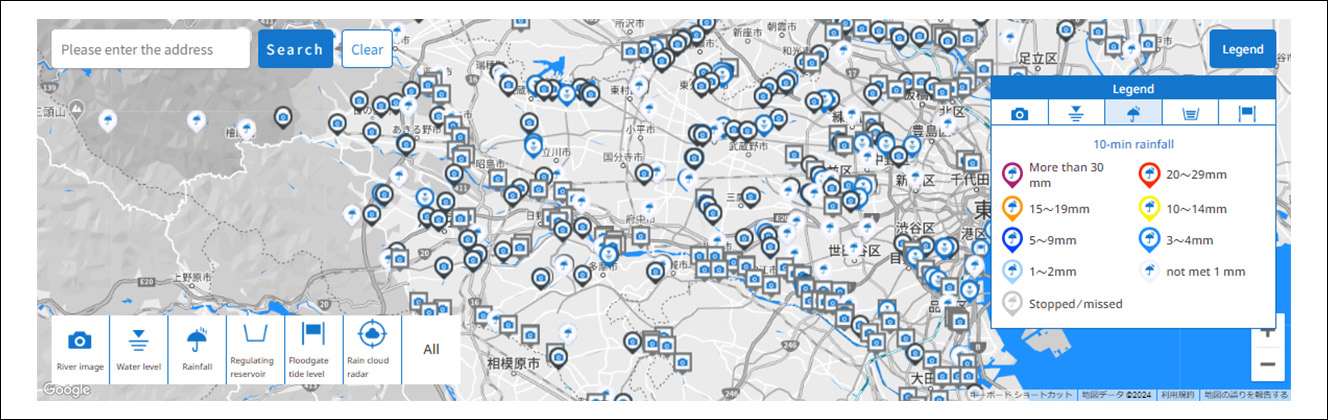
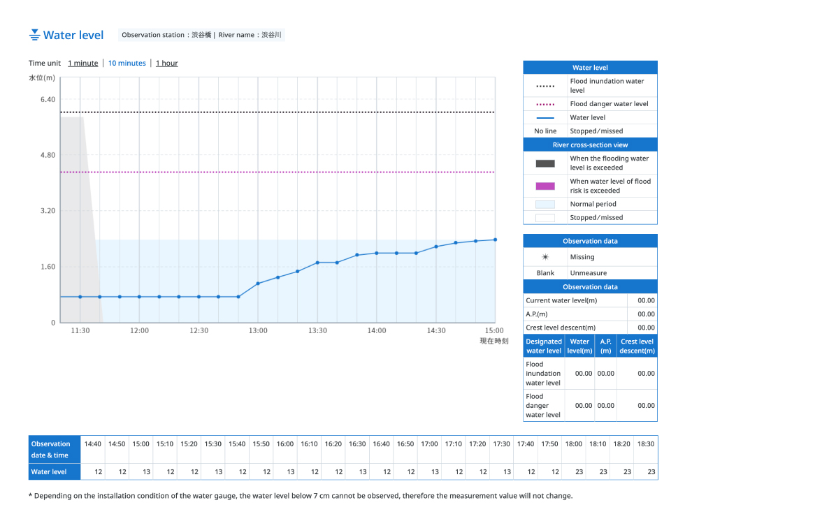
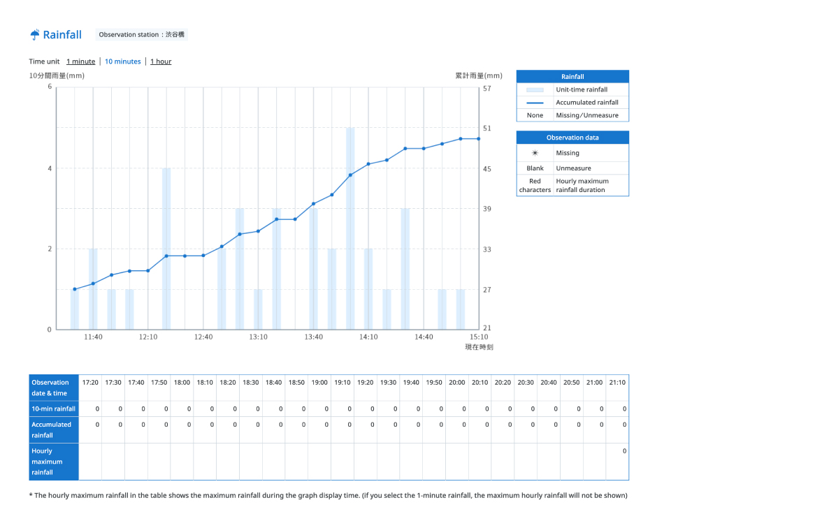
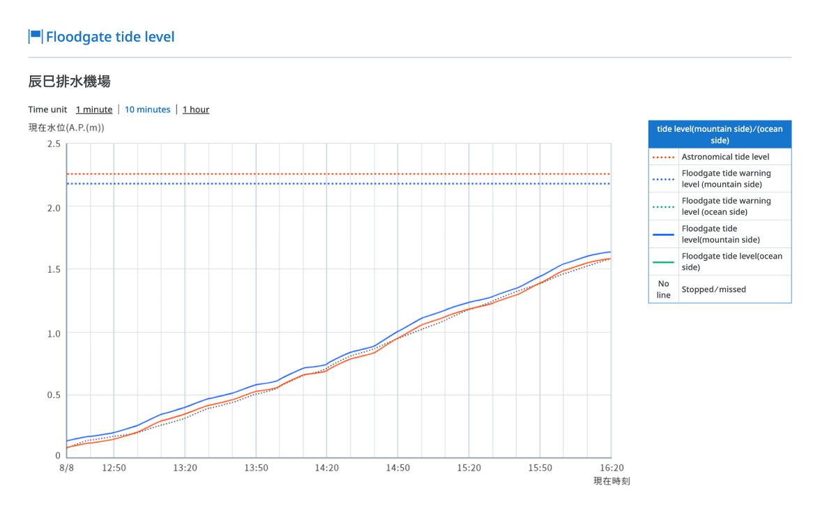
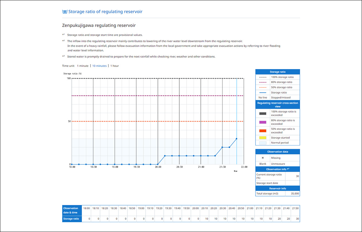
Observation data such as rainfall amount, river water level, tide level, etc. are automatically collected real time from the rain gauges/water gauges installed around the city, processed and 
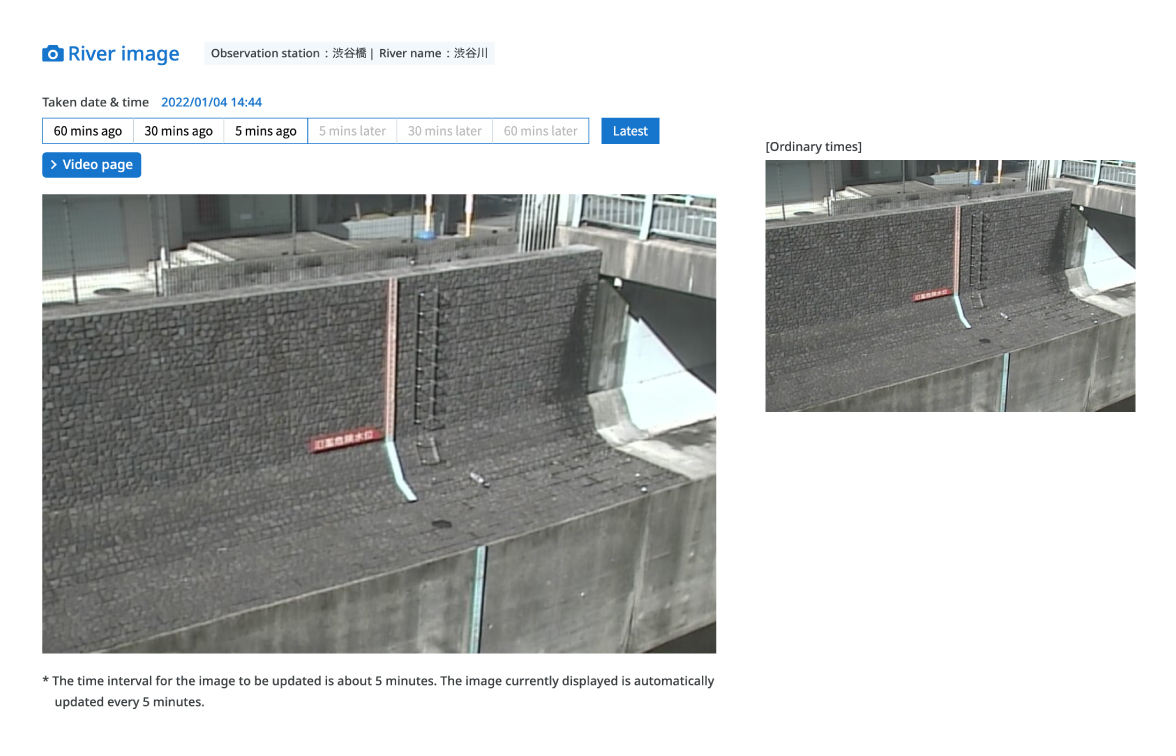
displayed on a map or in report tables. The river image data are also displayed.
Besides, other information such as weather warning/alarm/special alarm, sediment disaster alert information, flood forecast, etc. is also displayed real time.

Screen example of the Flood Control Integrated Information System

The following are screen examples of the Flood Control Integrated Information System.

Screen example of the Flood Control Integrated Information System

Example of river image display

The following is an example of a river image display.

Example of river image display

Example of water level graph display

The following is an example of a water level graph display.

Example of water level graph display

Example of rainfall graph display

The following is an example of a rainfall graph display.

Example of rainfall graph display

Example of floodgate tide level graph display

The following is an example of a floodgate tide level graph display.

Example of floodgate tide level graph display